

When an amateur restorer discovered slides showing street scenes from early 20th century Middleton – located near Manchester in the UK- he was keen to find out where exactly they were taken.
With the help of local historians, he was able to track down the location of some of the photos. But is there another way to identify where these historical photos were taken?
Using historical Ordnance Survey (OS) maps we were able to independently locate a number of the images. Here’s a quick guide to how we did it.
This is the best summary I could come up with:
When an amateur restorer discovered slides showing street scenes from early 20th century Middleton – located near Manchester in the UK- he was keen to find out where exactly they were taken.
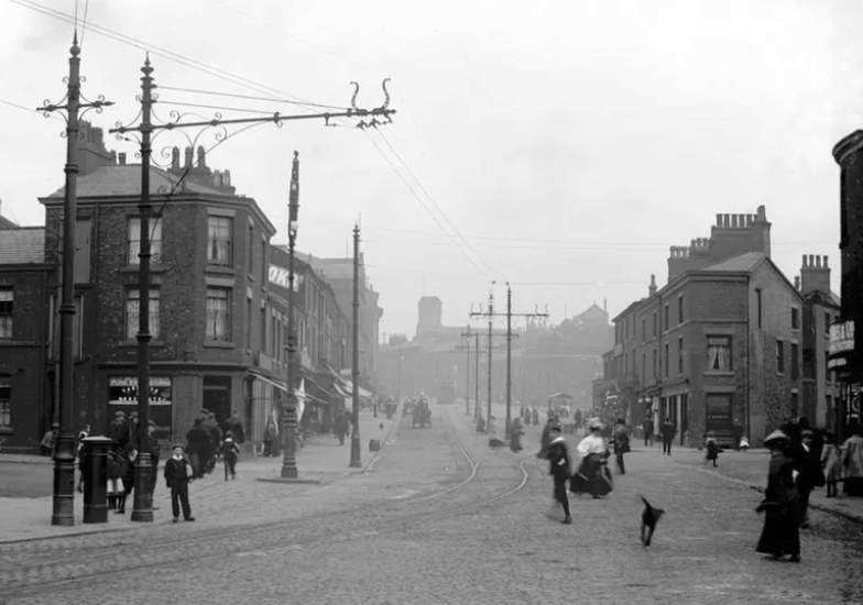
This historical photo holds the first clue, a street sign with the name ‘Manchester Old Road’ can be seen on the left-hand side of the image.
We then searched Google for (“Manchester Old Road” Middleton 1900 maps) and found a relevant page on StreetList.co.uk, a tool for navigating and exploring geographical information in the UK.
We found the National Library of Scotland provides many high-quality historical maps that you can view and explore without payment or subscription.
Here’s another example of an historical photo we geolocated further down the road, by examining the ordnance survey, other postcards of the area and Street View.
With thanks to Roger Liptrot for sharing information about the historical photos he found of Middleton, UK and for digitising the images from the original glass slides.
The original article contains 641 words, the summary contains 162 words. Saved 75%. I’m a bot and I’m open source!